Clear Lake - (Muskoka Lakes)
There another 4 Clear Lake's : Clear Lake in Oakley of Bracebridge Clear Lake in Burton of Whitestone Clear Lake in Humphrey of Seguin Clear Lake in Perry of Perry
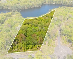
Clear Lake is situated in the geographic township of Wood in the Township of Muskoka Lakes. The lake is located south of the village of Torrance and Highway 169.
Average traveling time from the GTA to Clear Lake - (Muskoka Lakes) is 1 hour 57 mins
This Lake Median Lake Average Lake | |
Clear Lake is 149 hectares (368 Acres) in size The median size lake in our area is 71 hectares or 175 Acres (average size 398 hectares) | 149 71 398 |
|
Clear Lake has a maximum depth 17 meters (56 ft)
The median depth of lakes in our area is 13.5 m or 44 ft (average depth 18 m) | 17 13.5 18 |
| The median depth of Clear Lake is 8.00 m (26 ft) | 8.00 5.2 7 |
|
Clear Lake Perimeter 7.00 km (4.35 Miles)
The median perimiter of lakes in our area is 3.3 km or 2.05 miles (average Perimiter 3.61 km) | 7.00 3.3 4 |
| Clear Lake Island/s Perimeter 1.00 km (0.62 Miles) | |
|
Clear Lake Altitude 244 m (801 ft)
The median altitude of lakes in our area is 290 m or 951 ft (average Altitude is 289 m) | 244 290 289 |
|
Water Clarity of Clear Lake (median 3.2 m) 7.40 m (24ft)
The median Secchi Depth of lakes in our area is 3.2 m or 10 ft (average Secchi Depth is 3 m) | 7.40 3.2 3 |
|
Clear Lake's phosphorus content in water is 6.60 ug/L
The median Phosphorus content in the water of lakes in our area is 8 ug/l (average Phosphorus content 9 ug/L | 6.60 8 9 |
| Clear Lake's watershed area feeding the Lake (excluding lake) 1.1 km2 (272 acres) | |
| Lake Trout found in Clear Lake: No | |
| Drainage Basin of Clear Lake Lake Muskoka | |
| Clear Lake is in the Township of Wood | |
| Local Name of Clear Lake is Torrance Lake | |
| Shoreline Development on Clear Lake is: high; shoreline residential | |
| Public Access to Clear Lake public boat launch is planned for construction in 2014 | |
| Water Level Management not regulated | |
| Major Fish Species in Clear Lake (I), (I), , (I 2007) | |
| Other Fish Species in Clear Lake (I), , (I), ,, | |
| Other Species in Clear Lake spiny water flea (I 2006) | |
| Number of Cottages on Lake 132 | |
| Notes: E: extirpated, I: introduced – intentional or accidental, O: occasional, R: remnant, S: currently stocked, ?: status uncertain, 2009: year of first record or introduction if known, blank: presumed native | |
| Much of the above data for Clear Lake is compliments of the Muskoka Water Web maintained by The District Municipality of Muskoka | |
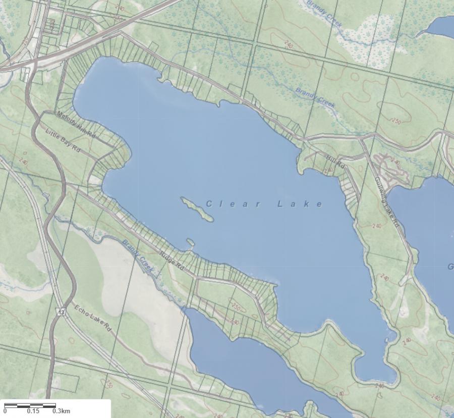
Maps of Clear Lake
Topographical Map of Clear Lake in Muskoka Lakes
Legend
 Buildings surrounding Clear Lake
 Buildings surrounding Clear Lake
 Conservation Area surrounding Clear Lake
 Contours of land surrounding Clear Lake
 Index Contour
 Rapids
 Spot Height
 Water Falls
 Water Falls/Rapids
 Waterbody Elevation
 Watercourse
 Wetland surrounding Clear Lake
 Wooded Area surrounding Clear Lake
Zoning Map of Clear Lake in Muskoka Lakes
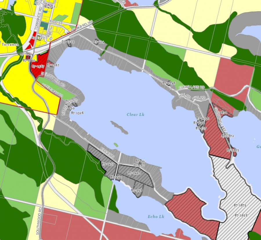
Legend of Muskoka Lakes Zoning Map - Clear Lake
Waterfront ResidentialEnvironmentally Protected
Community Residential
Open Space
Rural
Residential Rural
Waterfront Landing
Waterfront Commercial
Waterbody Open Space
Crown Land Map of Clear Lake in Muskoka Lakes
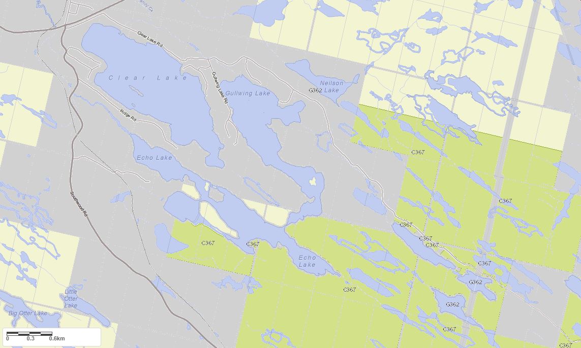
Legend for Crown Land Map
Private Land surrounding Clear Lake - (Muskoka Lakes)Provincial Park surrounding Clear Lake - (Muskoka Lakes)
Crown Land surrounding Clear Lake - (Muskoka Lakes) (General Use)
Conservation Reserve surrounding Clear Lake - (Muskoka Lakes)
Lake Contour Maps showing the depths of Clear Lake
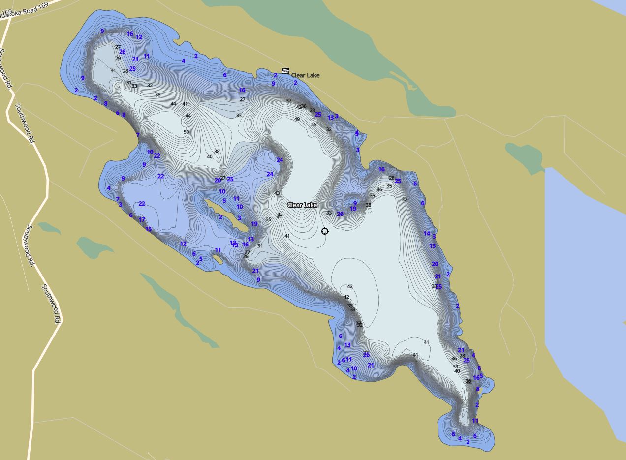
This map is courtesy of Gps Nautical Maps and you can purchase this map as an app from GpsNauticalCharts.com
All measurements of the countour map showing the depths of Clear Lake are in feet.