McKay Lake - (Bracebridge)
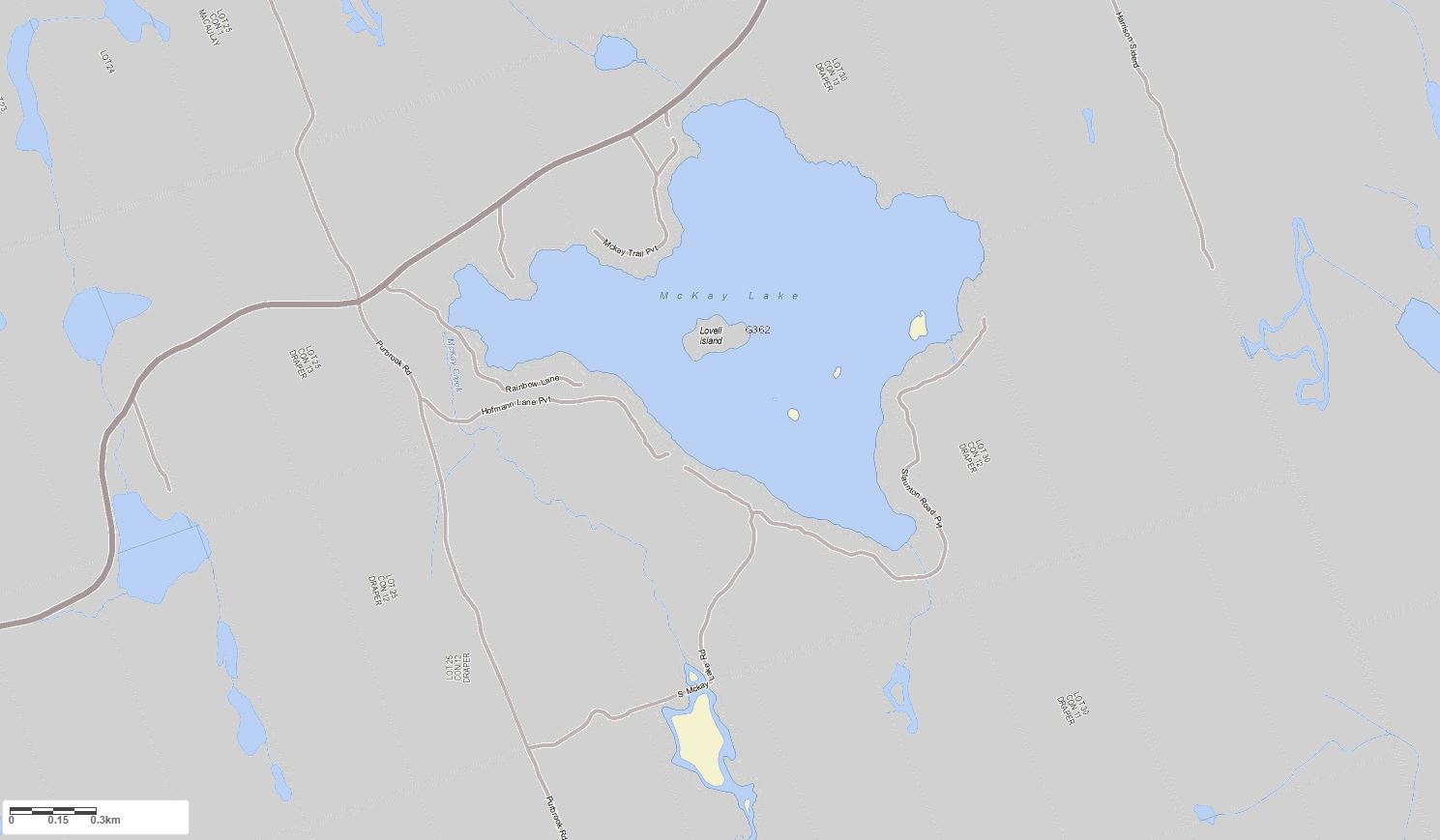
McKay Lake is located approximately 10 km east of Bracebridge on the south side of Muskoka Rd 14. McKay Lake is a headwater lake, meaning that it has no upstream lakes within its watershed. It flows south via McKay Creek into the South Branch of the Muskoka River.
Average traveling time from the GTA to McKay Lake - (Bracebridge) is 2 hours 5 mins
This Lake Median Lake Average Lake | |
McKay Lake is 132 hectares (326 Acres) in size The median size lake in our area is 71 hectares or 175 Acres (average size 398 hectares) | 132 71 398 |
|
McKay Lake has a maximum depth 19 meters (62 ft)
The median depth of lakes in our area is 13.5 m or 44 ft (average depth 18 m) | 19 13.5 18 |
| The median depth of McKay Lake is 4.80 m (16 ft) | 4.80 5.2 7 |
|
McKay Lake Perimeter 7.00 km (4.35 Miles)
The median perimiter of lakes in our area is 3.3 km or 2.05 miles (average Perimiter 3.61 km) | 7.00 3.3 4 |
| McKay Lake Island/s Perimeter 1.20 km (0.75 Miles) | |
|
McKay Lake Altitude 302 m (991 ft)
The median altitude of lakes in our area is 290 m or 951 ft (average Altitude is 289 m) | 302 290 289 |
|
Water Clarity of McKay Lake (median 3.2 m) 3.10 m (10ft)
The median Secchi Depth of lakes in our area is 3.2 m or 10 ft (average Secchi Depth is 3 m) | 3.10 3.2 3 |
| 9 % of McKay Lake shorline is wetland. The median percentage of shoreline which is wetland of lakes in our area is 9 % (average Percentage of shoreline which is wetland 10) % |
Percentage of Shoreline which is wetland 9 9 10 |
|
McKay Lake's phosphorus content in water is 8.60 ug/L
The median Phosphorus content in the water of lakes in our area is 8 ug/l (average Phosphorus content 9 ug/L | 8.60 8 9 |
| McKay Lake's watershed area feeding the Lake (excluding lake) 6.2 km2 (1532 acres) | |
| Lake Trout found in McKay Lake: No | |
| Drainage Basin of McKay Lake South Muskoka River | |
| McKay Lake is in the Township of Draper | |
| Shoreline Development on McKay Lake is: High; shoreline residential | |
| Public Access to McKay Lake Private | |
| Water Level Management Not regulated | |
| Major Fish Species in McKay Lake (I), (E), , (I), (I), (I), (I) | |
| Other Fish Species in McKay Lake creek chub, trout-perch, , , , golden shiner | |
| Notes: E: extirpated, I: introduced – intentional or accidental, O: occasional, R: remnant, S: currently stocked, ?: status uncertain, 2009: year of first record or introduction if known, blank: presumed native | |
| Much of the above data for McKay Lake is compliments of the Muskoka Water Web maintained by The District Municipality of Muskoka | |
Maps of McKay Lake
Topographical Map of McKay Lake in Bracebridge
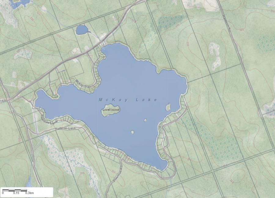
Legend
 Buildings surrounding McKay Lake
 Buildings surrounding McKay Lake
 Conservation Area surrounding McKay Lake
 Contours of land surrounding McKay Lake
 Index Contour
 Rapids
 Spot Height
 Water Falls
 Water Falls/Rapids
 Waterbody Elevation
 Watercourse
 Wetland surrounding McKay Lake
 Wooded Area surrounding McKay Lake
Zoning Map of McKay Lake in Bracebridge
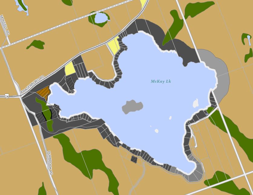
Legend of Bracebridge Zoning Map - McKay Lake
SR1 - Shoreline Residential 1EP1 - Environmentally Protected 1
RU - Rural
RR - Rural Residential
OP1 - Open Space 1
OP2 - Open Space 2
OP3 - Open Space 3
R1 - Residential
Crown Land Map of McKay Lake in Bracebridge
Legend for Crown Land Map
Private Land surrounding McKay Lake - (Bracebridge)Provincial Park surrounding McKay Lake - (Bracebridge)
Crown Land surrounding McKay Lake - (Bracebridge) (General Use)
Conservation Reserve surrounding McKay Lake - (Bracebridge)
Lake Contour Maps showing the depths of McKay Lake
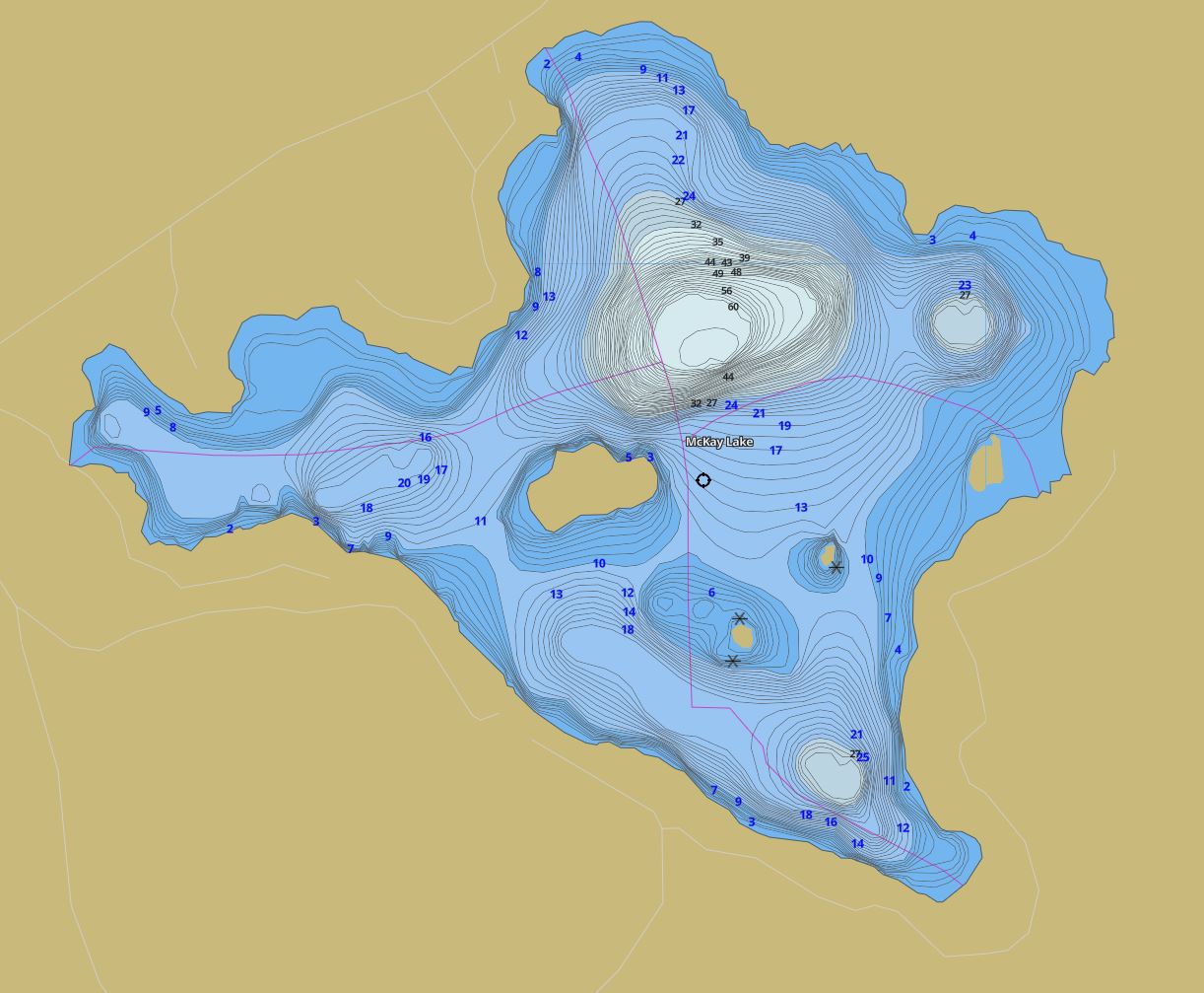
This map is courtesy of Gps Nautical Maps and you can purchase this map as an app from GpsNauticalCharts.com
All measurements of the countour map showing the depths of McKay Lake are in feet.
Snowmobile Trails Surrounding McKay Lake
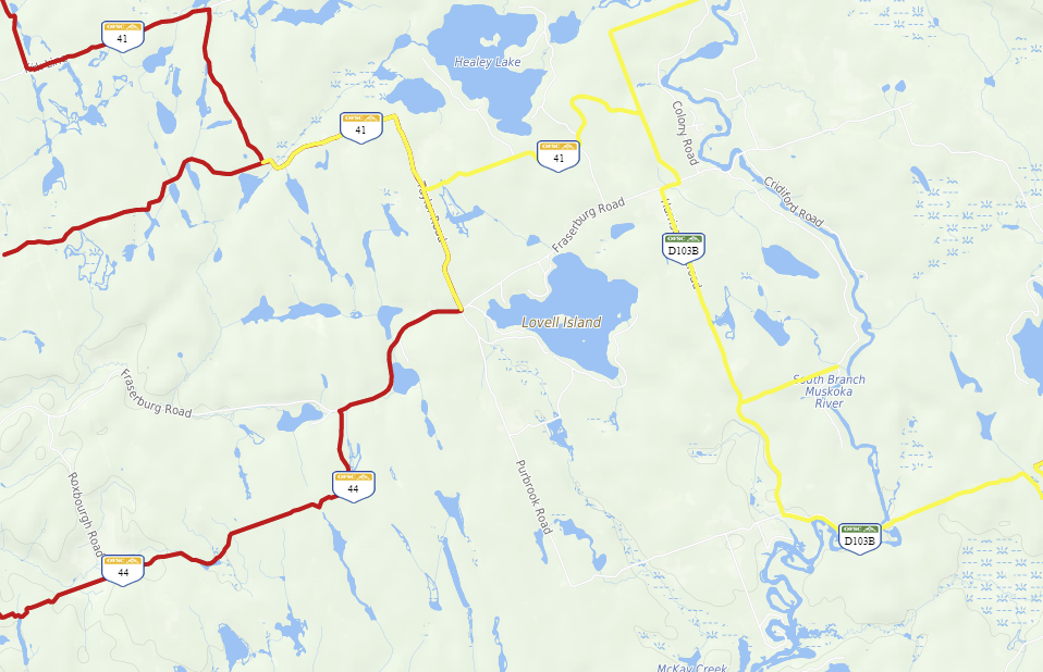
This map is courtesy of Ontario Federation of Snowmobile Club Interactive Trail Map
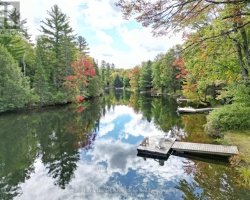
Islands on McKay Lake in Bracebridge, Muskoka
| Official Name | Lovell Island |
|---|---|
| Perimeter of Lovell Island | 0.46 km (0.29 miles) |
| Area of Lovell Island | 2.14 Hectares (5.29 Acres) |
| Properties on Lovell Island | 1 |
| View on interactive Map | Locate Lovell Island on Bing Maps |
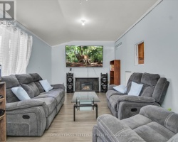
Cottages for Sale on McKay Lake - (Bracebridge)
Sorry no cottages for sale at the moment on McKay Lake (Bracebridge)