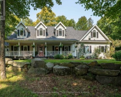
Kawagama Lake - (Algonquin Highlands)
Kawagama Lake is a large and beautiful lake located in the Haliburton Highlands region of Ontario, Canada. It is situated in the township of Algonquin Highlands and covers an area of approximately 3,150 hectares. Kawagama Lake is the largest lake in the Haliburton Highlands and the 23rd largest lake in Ontario. Kawagama Lake is a popular destination for recreational activities such as swimming, boating, and fishing. The lake is home to a variety of fish species, including lake trout, smallmouth bass, and yellow perch. The lake's shoreline is mostly undeveloped and is surrounded by forests, providing visitors with stunning natural scenery and wildlife viewing opportunities. There are several cottage and resort properties located on the shores of Kawagama Lake, providing visitors with a range of accommodation options. The lake is easily accessible by car and is located about three hours north of Toronto. The lake is also known for its crystal clear water and excellent water quality, making it a popular destination for swimming and other water activities. Overall, Kawagama Lake is a beautiful and serene destination that offers a variety of outdoor activities and natural beauty for visitors to enjoy.
This Lake Median Lake Average Lake | |
Kawagama Lake is 3150 hectares (7784 Acres) in size The median size lake in our area is 71 hectares or 175 Acres (average size 398 hectares) | 3150 71 398 |
|
Kawagama Lake has a maximum depth 73 meters (240 ft)
The median depth of lakes in our area is 13.5 m or 44 ft (average depth 18 m) | 73 13.5 18 |
| The median depth of Kawagama Lake is 22.00 m (72 ft) | 22.00 5.2 7 |
|
Kawagama Lake Perimeter 109.00 km (67.73 Miles)
The median perimiter of lakes in our area is 3.3 km or 2.05 miles (average Perimiter 3.61 km) | 109.00 3.3 4 |
| Kawagama Lake Island/s Perimeter 24.00 km (14.91 Miles) | |
|
Kawagama Lake Altitude 383 m (1257 ft)
The median altitude of lakes in our area is 290 m or 951 ft (average Altitude is 289 m) | 383 290 289 |
|
Water Clarity of Kawagama Lake (median 3.2 m) 7.90 m (26ft)
The median Secchi Depth of lakes in our area is 3.2 m or 10 ft (average Secchi Depth is 3 m) | 7.90 3.2 3 |
| Kawagama Lake's watershed area feeding the Lake (excluding lake) 363.0 km2 (89699 acres) | |
| Drainage Basin of Kawagama Lake Hollow River | |
| Kawagama Lake's percentage of shoreline which is Crown Land 60 % | |
| Kawagama Lake is in the Township of Sherborne | |
| Local Name of Kawagama Lake is Hollow Lake | |
| Shoreline Development on Kawagama Lake is: Moderate; shoreline residential, commercial, recreation camp | |
| Public Access to Kawagama Lake .Public launches at Kawagama L Road, Bear L Road, McClintock Road;private launches at marinas | |
| Water Level Management Regulated; water level is controlled by MNR-owned and operated dam. Flows and levels are governed by the Muskoka River Water Management Plan. | |
| Major Fish Species in Kawagama Lake (R), , lake whitefish, cisco (), round whitefish, (I), , (I), (I), (I?), (? I 2015), (? I 2015) | |
| Other Fish Species in Kawagama Lake lake chub, northern redbelly dace, , finescale dace, ninespine stickleback,brook stickleback, , , Iowa darter, common shiner,bluntnose minnow, blacknose dace, longnose dace, creek chub | |
| Other Species in Kawagama Lake spiny water flea (I 2000) | |
| Notes: E: extirpated, I: introduced – intentional or accidental, O: occasional, R: remnant, S: currently stocked, ?: status uncertain, 2009: year of first record or introduction if known, blank: presumed native | |
| Much of the above data for Kawagama Lake is compliments of the Muskoka Water Web maintained by The District Municipality of Muskoka | |
Maps of Kawagama Lake
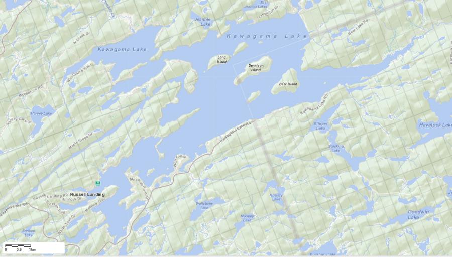
Topographical Map of Kawagama Lake in Algonquin Highlands
Legend
Zoning Map of Kawagama Lake in Algonquin Highlands
Crown Land Map of Kawagama Lake in Algonquin Highlands
Legend for Crown Land Map
Private Land surrounding Kawagama Lake - (Algonquin Highlands)Provincial Park surrounding Kawagama Lake - (Algonquin Highlands)
Crown Land surrounding Kawagama Lake - (Algonquin Highlands) (General Use)
Conservation Reserve surrounding Kawagama Lake - (Algonquin Highlands)
Lake Contour Maps showing the depths of Kawagama Lake
This map is courtesy of Gps Nautical Maps and you can purchase this map as an app from GpsNauticalCharts.com
All measurements of the countour map showing the depths of Kawagama Lake are in feet.
